Real cities.
Every level.
Pick an area on the map. Citylith builds it in your scene from OpenStreetMap and survey data: streets, bridges at their real heights, ground and buildings.
Early Access is open: 3ds Max 2024 to 2027 and Blender 4.2 to 5.x on Windows, from €99 a year.
 You pick an area. Scroll ↓

Citylith builds it. In 3ds Max or Blender.
Central Park, New York4.7 km across
From the map to your project.
No modelling and no cleanup. One panel does the work, inside 3ds Max or beside Blender.


Your building in its real street, ready to render in V-Ray, Corona or Arnold, or in Cycles in Blender.
Everything around your project.
Thirteen families, each on its own layer.5 See all thirteen families it builds
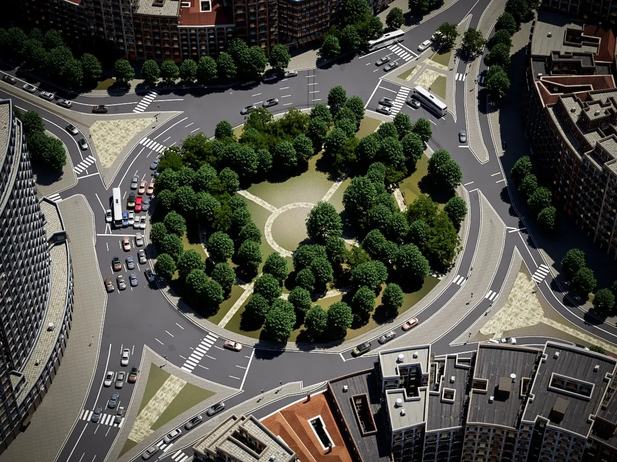
![A roundabout in Barcelona built by Citylith: welded streets with rounded kerbs, crossings and trees]() Barcelona
Streets and junctions
One welded surface with rounded kerbs. No overlapping road pieces.
![Ramps and bridge decks curving over a river in Tokyo at their real heights, built by Citylith]() Tokyo
Bridges and ramps
Decks, ramps and tunnels at their real levels.
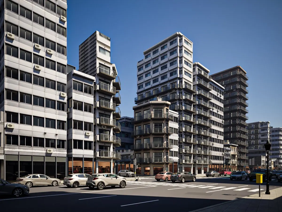
![Mid-rise and tower buildings in regional facades on a Tokyo street, built by Citylith]() Tokyo
Buildings
Official 3D buildings where published, regional facades everywhere.
![Survey terrain of the hills of Los Angeles, banded by surface with trees, built by Citylith]() Los Angeles
Ground and terrain
Survey ground banded by surface: grass, gravel, paving.
![A Los Angeles beach with the sea, the shore and the town behind it, built by Citylith]() Los Angeles
Water and shores
Quay walls in town, natural banks outside it.
![Street trees, a lamp post, a traffic signal and crossings on a New York corner, built by Citylith]() New York
Trees and furniture
From the map. Forest Pack, Chaos Cosmos or splines.
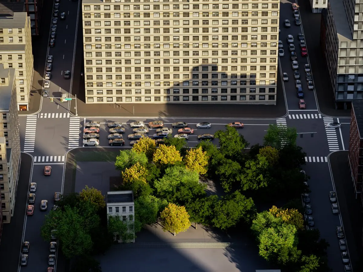
![Cars from a traffic simulation queued at New York crossings around a small park, built by Citylith]() New York
Traffic
Cars from a traffic simulation, queued where they should be.
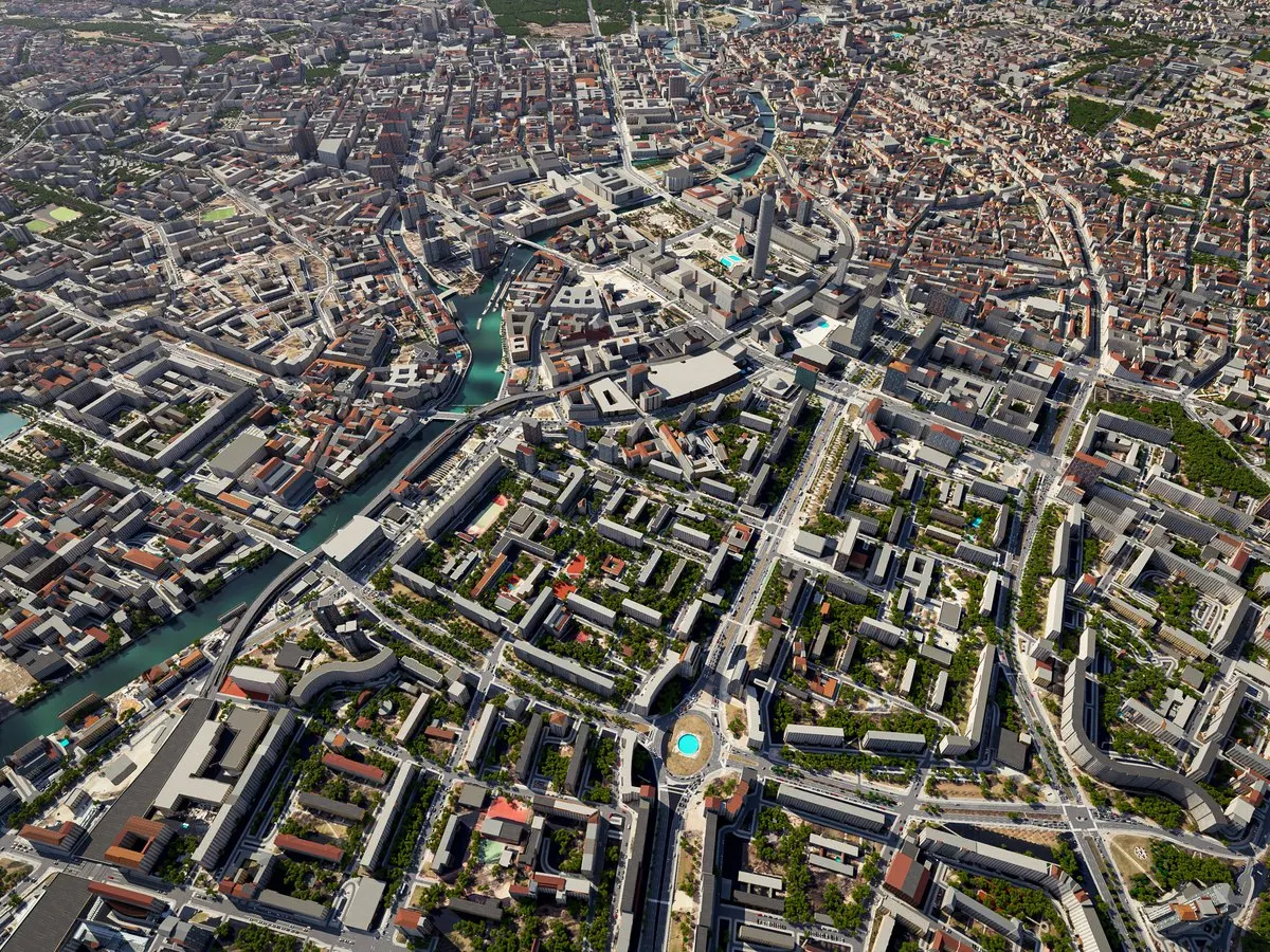
![Berlin built by Citylith as one city of 49 tiles, 7 × 7 km]() Berlin
Whole cities
Square tiles that build outside Max and fit exactly.



Same streets. Now with levels.
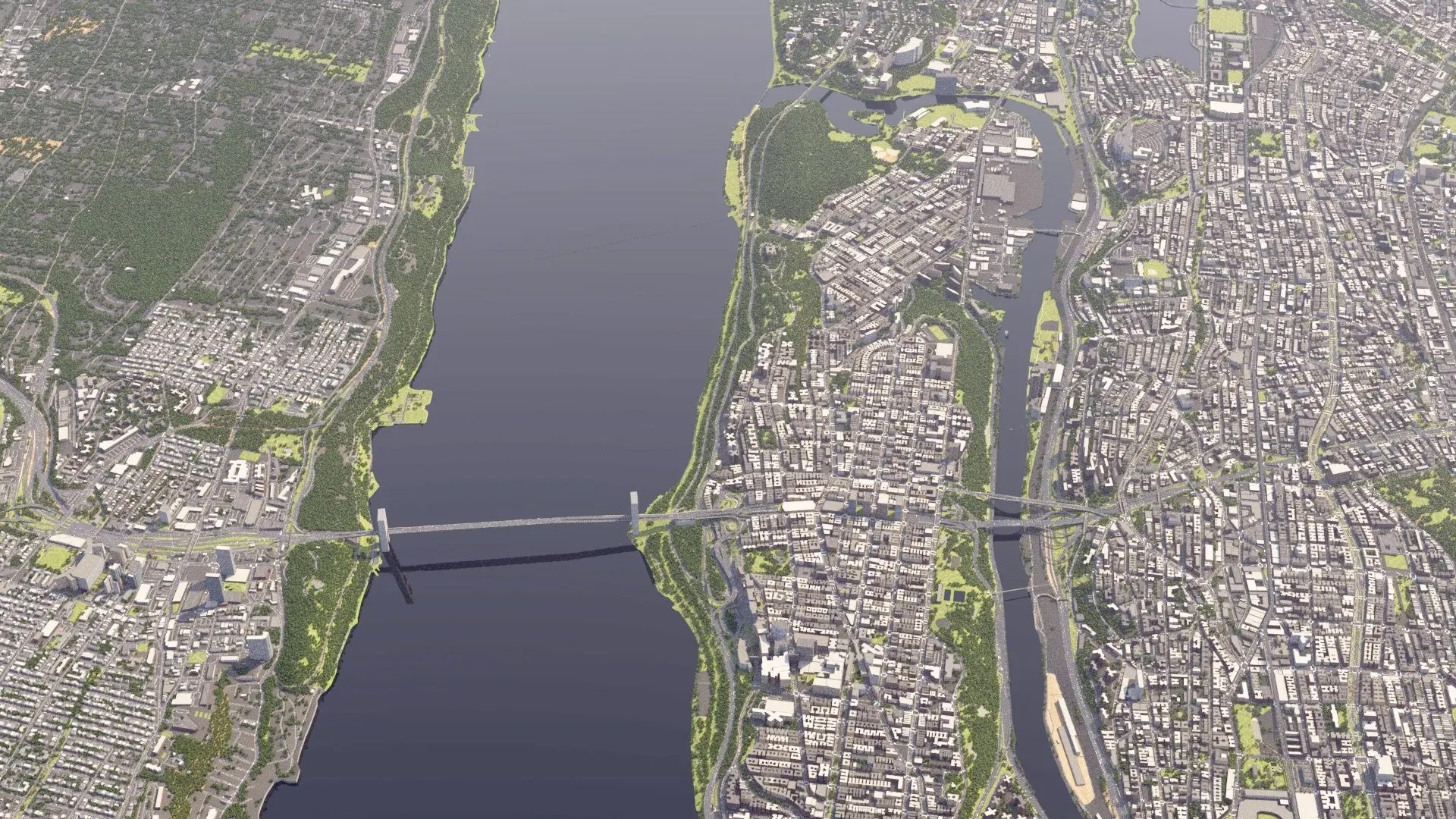
Map data has no heights, so ramps and bridges fall flat.1 Citylith builds every level. Drag to compare, or open the build in 3D.


Washington Bridge. The deck rises off the river.Cross Bronx × Major Deegan. The loops pass over each other.
Buildings that belong where they stand
- ParisHaussmann limestone

- AmsterdamBrick canal gables

- New YorkPre-war brick and towers

- TokyoBayfront towers and expressways

- Eastern EuropePanel blocks and towers

- DubaiTowers and interchanges

Every building wears a facade from its own part of the world: 257 sets in 24 regions, picked by use and storeys, with towers and mid-rise blocks of their own. Where governments publish measured 3D buildings, Citylith uses them, roofs and all.
See the quality in each placeBuilt from official data.
Streets from OpenStreetMap. Ground and, where published, buildings from government surveys.
- facade sets in 24 regions
- 257
- Chosen by region, use and storeys.
Five steps. One panel.
The city generator lives inside 3ds Max, or in the Citylith window of Blender. It tells you how long a build will take and builds into the scene you have open.
- 01 / 05
Where
An area on the map or a whole city, its size, full detail near one point, and the ground: an aerial photo or satellite colour with textures.

- 02 / 05
What
Tick the families, from the ground and roads to buildings, trees and cars.

- 03 / 05
Trees, cars, furniture
Forest Pack or splines, Chaos Cosmos models, and how much traffic.

- 04 / 05
Look
Roofs, day or night facades, detailed buildings, and what to do with buildings the map gives no height.

- 05 / 05
Build
See how long it will take, then build. A rebuild replaces only Citylith’s objects; yours stay.

Need one site, not the plugin?
We build it for you, cleaned and ready to render, as a 3ds Max scene. From €190 for 500 × 500 m.
Early Access is open.
- NowCitylith for 3ds Max and BlenderEarly Access, one installer
- NextWhole-city rebuildsKeep your edits on tiled cities too
- Ask usOther appsCinema 4D or Unreal: tell us which you use
From €99 a year. Compare the plans. Waitlist members: your founders code is in your invitation email.
Your next site. Already built.
Early Access is open, from €99 a year. Waitlist members pay the founders price with the code from their invitation.
Which 3ds Max and Blender versions?
3ds Max 2024, 2025, 2026 and 2027, and Blender 4.2 LTS, 4.5 LTS and 5.x, on Windows. One installer asks which of them you use. See Citylith for Blender.
Is Blender the same licence?
Yes. Every plan covers 3ds Max and Blender. Your licence counts computers, not apps: both on the same computer use one computer, or one Studio seat.
How much does it cost?
Basic €99, Pro €299 and Studio €699 a year, before tax. Waitlist members pay the founders price for the first year with the code from their invitation. Compare the plans.
Where does the data come from?
Streets from OpenStreetMap; ground and, where they exist, measured 3D buildings from government data; global data everywhere else. How precise a build is depends on the place: see coverage.
Can I use the result in client work?
Yes. Renders, animations, presentations, competitions and client deliveries are all fine, and the data sources allow commercial use with attribution. You may not sell or share the 3D files themselves, for example on model stores.
Does it use Google 3D tiles?
No. Citylith builds clean geometry from open and government data that you keep in your scene and can deliver.
Do I need to be online?
Yes, while building: each build checks your licence and downloads the map, elevation and building data for the area you pick. The scenes you built open and render offline.
How do updates arrive?
Inside Citylith: in 3ds Max, and in the Citylith window in Blender. When a new version is out, Citylith shows what is new and downloads only the files that changed. Updates are included in every plan. See what's new.
Does it place cars and trees?
Yes. Trees and street furniture come from the map, cars from a traffic simulation. The trees are Citylith's own, 18 species, each in three versions picked by distance from the camera. In 3ds Max, place them with Forest Pack or as plain splines for your own scatter, or use Chaos Cosmos models; in Blender, Citylith places them itself. Trees come with every plan; traffic and street furniture with Pro and Studio.
Can I build a whole city?
Yes, with Studio. The city is cut into square tiles that build outside 3ds Max, several at once, and fit together exactly. You can keep working in Max meanwhile. Pro builds tiled areas up to 4 × 4 km.
Which renderers?
In 3ds Max: V-Ray, Corona and Arnold, with a Physical fallback. In Blender: Cycles and EEVEE.
What about Cinema 4D or Unreal?
Not yet. Write to us and tell us which one you use.
- The map-data image shows the OpenStreetMap streets of the same area at their mapped widths, draped on the same terrain and seen from the same camera. The map stores no heights, so bridges and ramps lie on the ground.
- Countries and territories, in whole or in part: the United States, Canada, the United Kingdom (England, Wales, Scotland), France, the Netherlands, Belgium (Flanders), Luxembourg, Germany (ten states), Denmark, Norway, Poland, Czechia, Slovakia, Estonia, Austria, Switzerland, Portugal, Spain (Catalonia, the Basque Country, Navarre), Italy (South Tyrol), Japan, Hong Kong, Australia, New Zealand and Uruguay. See coverage.
- The Netherlands, Switzerland, New York City, Vienna, Japan (the cities with official 3D models), part of Estonia, and 14 German states: Baden-Württemberg, Bavaria, Berlin, Brandenburg, Bremen, Hamburg, Hesse, Lower Saxony, Mecklenburg-Vorpommern, North Rhine-Westphalia, Rhineland-Palatinate, Saarland, Saxony and Saxony-Anhalt. In France, measured heights where the map has none.
- Materials for V-Ray, Corona and Arnold, with a Physical fallback, in 3ds Max 2024 to 2027; for Cycles and EEVEE in Blender 4.2 LTS, 4.5 LTS and 5.x.
- Roads, bridges, sidewalks, walls, ground, water, buildings, trees, paths and fences, street furniture, rails, traffic and road markings. All thirteen build today.
- The Central Park image at the top is a V-Ray render of a real Citylith build. The region images (Paris, Amsterdam, New York, Tokyo, Eastern Europe, Dubai) are V-Ray renders of real Citylith builds of 0.5 to 1 km at each place, and so are the How it works images and the streets, bridges, buildings, ground, water, trees, traffic and whole-city images (the city is Berlin, 7 × 7 km in 49 tiles). So is the city at the foot of the page; the panel images are real screenshots. The 3D model is the same Citylith build (Washington Bridge over the Harlem River, New York), with its V-Ray light baked in. Citylith is in Early Access: it grows and changes through updates.