CITYLITH Join the waitlist
Harlem River, New York 40.8456 N, 73.9290 W 2 × 2 km, one build Rendered in a browser. Gold lines show the mesh; trees are stand-ins.

Real cities. Every level.

Pick an area on the map. Citylith builds it in 3ds Max: welded streets, and bridges and ramps at their real heights.

Early Access soon. The list gets the founders price.

Same streets. Now with levels.

Map data has no heights. Draped on the terrain, every ramp and bridge falls flat. Move the loupe over the build to see what the map alone gives you.
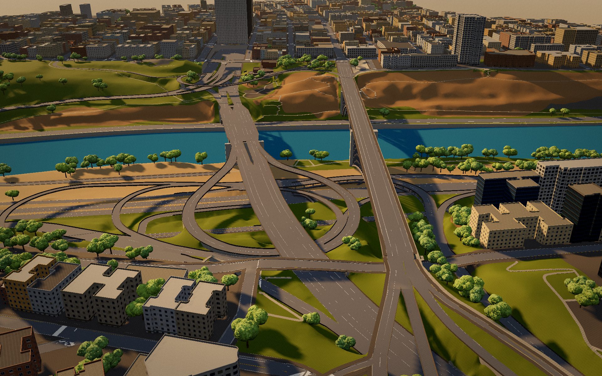
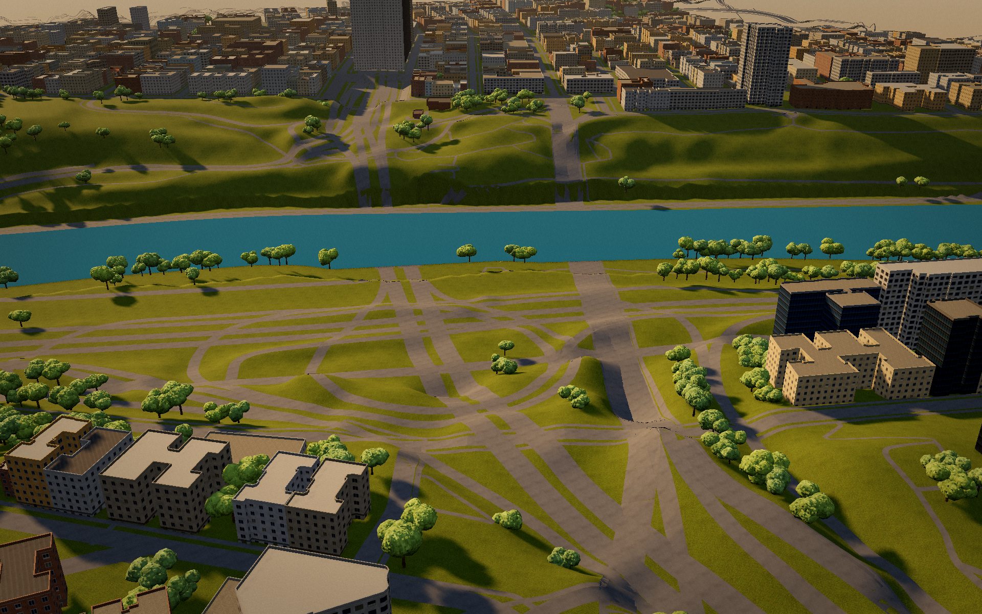
The area built by Citylith: the Washington Bridge deck and the loop ramps at their real heights The same area from raw OpenStreetMap data draped on the terrain: bridges lie on the river and the ramps cross at one height
Same camera, same terrain, same 2 × 2 km

AWashington Bridge. In the map data the deck lies on the river. Citylith builds it at its height, with the arch below.

BCross Bronx × Major Deegan loops. In the map data the ramps cross at one height. Citylith passes them over each other.

Turn it over. Take it apart.

The interchange from the comparison, exported from 3ds Max with the plugin's own materials. Orbit it, look under the decks, show the mesh, or split it into the layers Citylith builds.

7 MB, runs in your browser
  1. Bridge towers
  2. Parapets, railings, walls
  3. Markings
  4. Sidewalks and kerbs
  5. Roads and decks
  6. Ground and water
Cross Bronx × Major Deegan, the Bronx 840 m across 265,000 triangles Drag to orbit, scroll to zoom

Where context tools break, Citylith works hardest.

Aerial and masterplan shots show every street and every crossing. These are the parts we spend our time on.

On the street

One surface, no overlaps

Streets weld into one road mesh with curved kerb returns. No stacked faces where two roads meet.

Overpasses at their real height

Decks, ramps, tunnels, portals and retaining walls are built where the map puts them, with parapets and railings.

Under it and around it

Government survey ground

Bare-earth elevation from national surveys, including the US, Canada, England, France, Japan and Norway, with global coverage elsewhere.

Official 3D where it exists

Measured 3D buildings where governments publish them, such as the Netherlands, German states and Japan. Map footprints and heights everywhere else.

In your scene

Native to 3ds Max

Organised layers, splines ready for RailClone, trees through Forest Pack, and materials for V-Ray, Corona or Arnold.

Rebuild without losing edits

Change the settings and rebuild while your own edits stay. Studio builds whole cities as seamless tiles that weld at their edges.

Every family on its own layer.

Tick what you need in the panel and leave the rest. Each family arrives as one object on a named layer, with a material for your renderer.
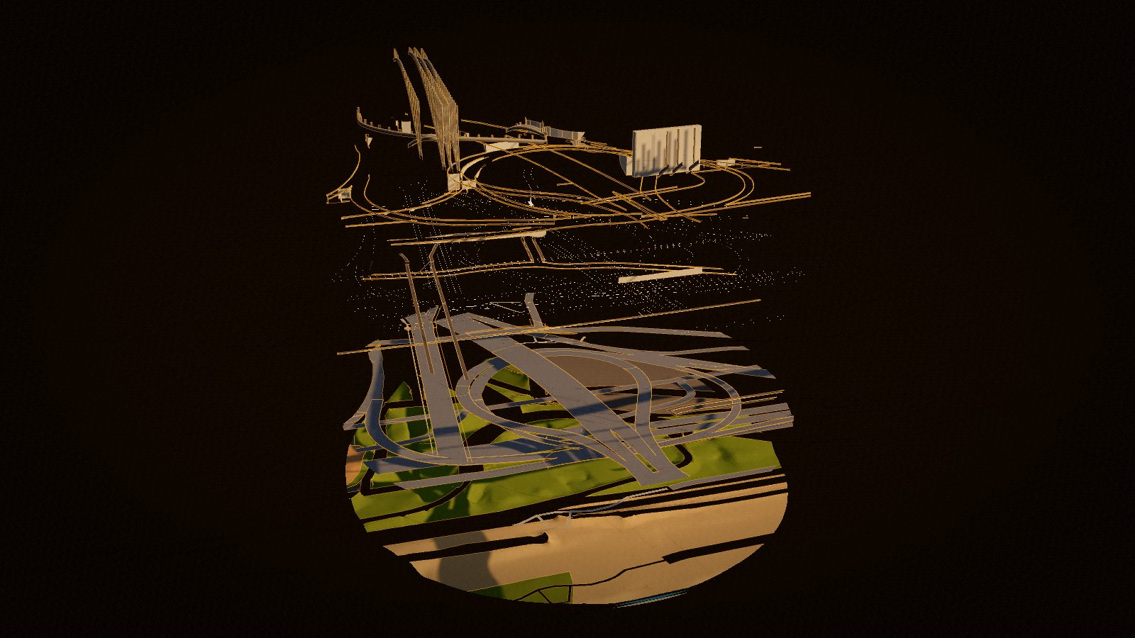
The interchange split into its layers, each one lifted above the next
The same interchange, layer by layer
  • RoadsOne welded surface with rounded kerb returns.HM_Roads
  • Bridges and decksReal heights, with parapets and railings.HM_Bridges
  • Sidewalks and kerbsPavements that follow the road edge.HM_Sidewalks
  • WallsRetaining walls where one level drops to another.HM_Walls
  • GroundTerrain banded by surface: grass, gravel, paving.HM_Ground
  • Buildings3D roofs or low-poly, textured facades.HM_Buildings
  • TreesAreas for Forest Pack, or plain geometry.HM_TreeAreas
  • WaterRivers, harbours and shores.HM_Water
  • Paths and fencesFootpaths, steps, fences, hedges, guard rails.HM_Fences
  • Street furnitureLamps, hydrants, benches and signs from the map.HM_Furn
  • Road markingsLane lines, crossings and stop lines.HM_Mark

Four steps in one panel.

  1. Where

    Pick the area on a map and set its size. The ground comes from survey data.

  2. What

    Choose the families to build: streets, levels, buildings, trees, water, furniture.

  3. Look

    Pick materials, roof style and detail for your renderer.

  4. Build

    See the estimated build time, then build it into your open scene.
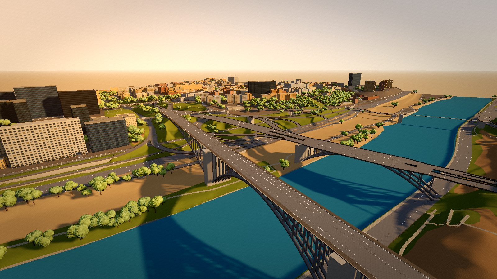
One build, many looks.

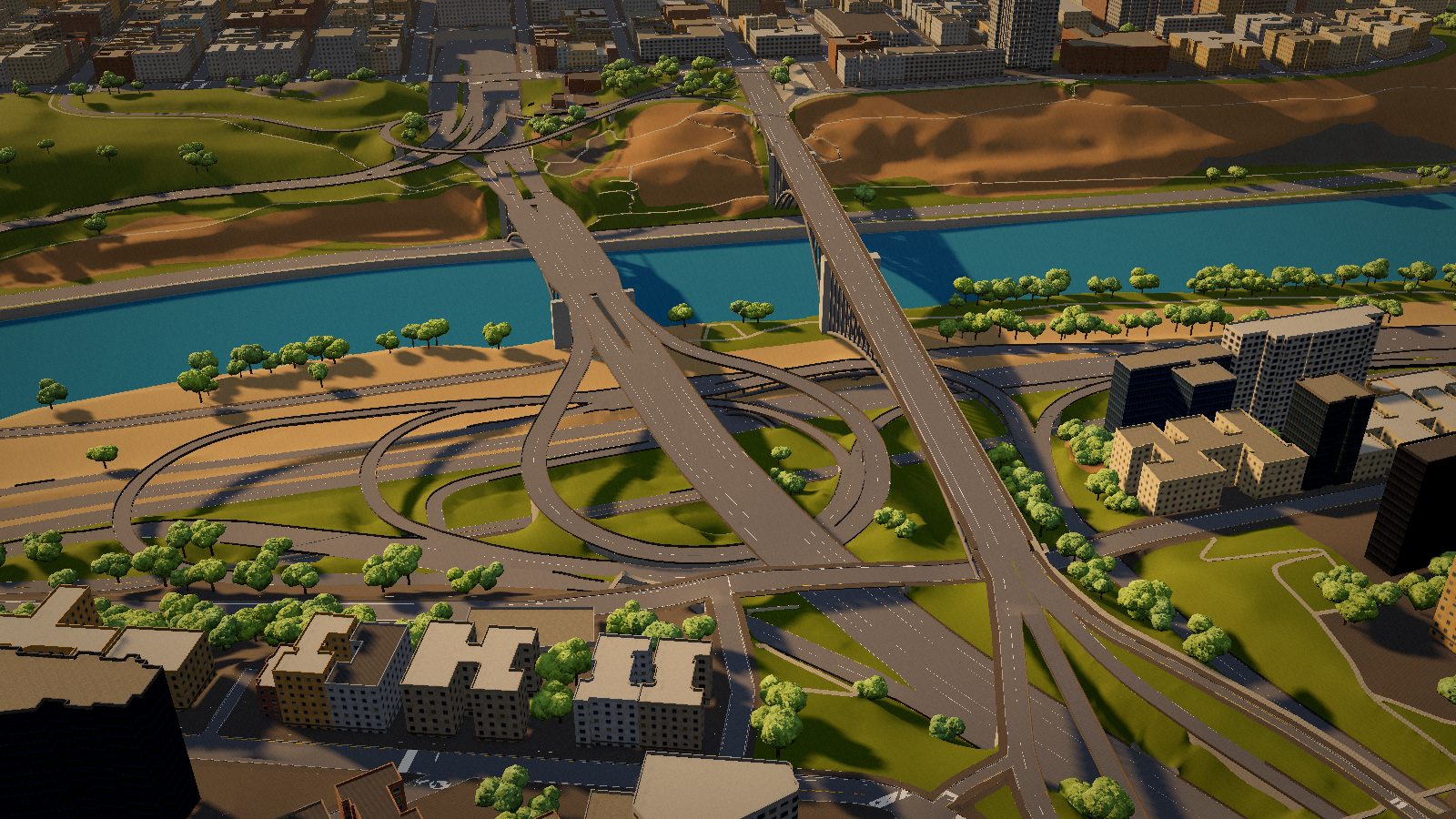
The Washington Bridge and the interchange from above the Harlem River
Washington Bridge and the Cross Bronx interchange
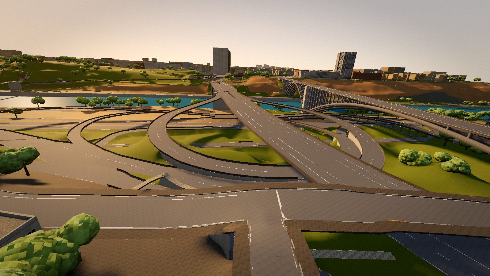
Low drone view over the ramps of the Cross Bronx interchange
Drone pass over the ramps
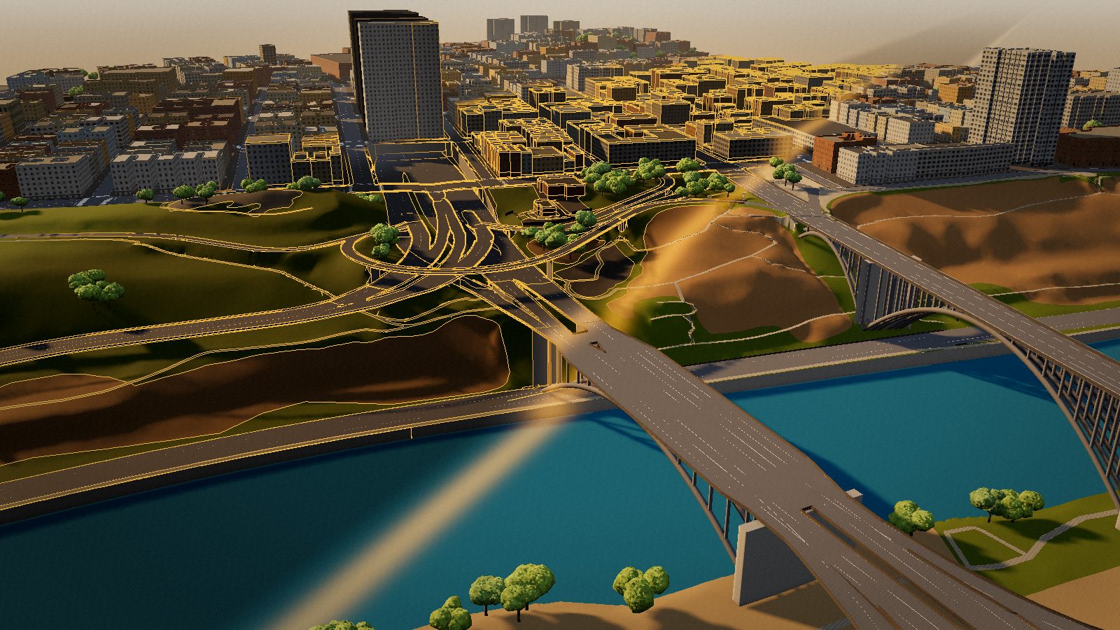
Gold mesh lines sweeping over the textured interchange
The mesh under the render
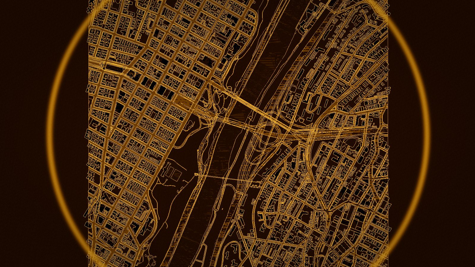
Top-down map view with glowing street lines
Map view, 2 × 2 km
The interchange seen from the side, lit low
The interchange, side light

Early Access, coming soon.

Citylith already builds real places end to end and gets better every week. Open map data is uneven, so some places come out cleaner than others. Early Access members send us the places that break and shape what gets fixed first.

  • Citylith for 3ds MaxEarly Access
  • Road markings for the new road builderEarly Access update
  • Citylith StandaloneIn development
  • Importers for Blender, Cinema 4D and UnrealPlanned

Pro

For freelancers and small studios. One seat.

Licence terms and price at launch. The list gets the founders price.

  • Build any area, anywhere the data covers
  • V-Ray, Corona, Arnold and Physical materials
  • Rebuild without losing your edits
Join the waitlist

Studio

For teams with several seats.

Licence terms and price at launch.

  • Everything in Pro
  • Whole cities as seamless tiles
Join the waitlist

Get the founders price.

Waitlist members get the founders price at launch and the first beta builds. One email at launch, a few before it. Unsubscribe any time.

We only use your email for Citylith news. See our privacy notice.

Questions

Which 3ds Max version?
3ds Max 2026 at launch. Support for other versions will be listed here before Early Access opens.
Where does the data come from?
Streets and buildings from OpenStreetMap, ground from national elevation surveys and a global elevation model, 3D buildings from official open datasets. Every source is credited.
Can I use the result in client work?
Yes. The data sources allow commercial use with attribution, and the build is yours to edit, render and deliver.
Does it use Google 3D tiles?
No. Citylith builds clean geometry from open and government data that you keep in your scene and can deliver.
Do I need to be online?
Yes, while building. The map, elevation and building data download for the area you pick.
What about Blender, Cinema 4D or Unreal?
A standalone version with importers for those tools is in development. Join the waitlist and tell us which one you use.

Your next site. Already built.

Join the waitlistCitylith by HM Studio